
Sulphur Mines Investigation
MAIN MENU:
This page was last updated on 06/03/2025 at 10:45:13 AM.
Maps
| Bathymetric Surveys and Maps |
Q1 2024 - received 2-5-2024
Q2 2024 - received 4-15-2024
Q2 2024 (with differential contours) - received 5-11-2024
Q3 2024 - received 7-29-2024
Q1 2025 - received 3-6-2025
Q2 2025 - received 6-2-2025
| Current Dome Maps |
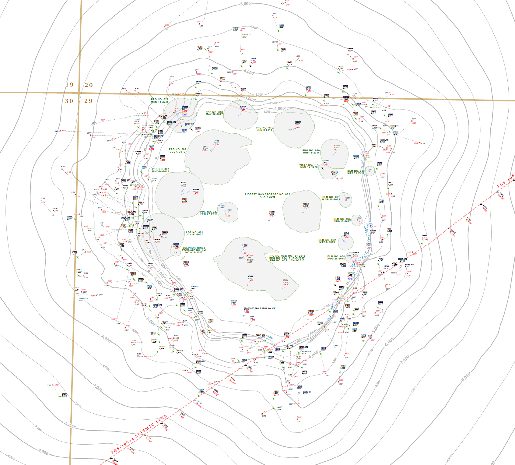
LDENR Area of Concern (AOC) for Sulphur Mines Dome:
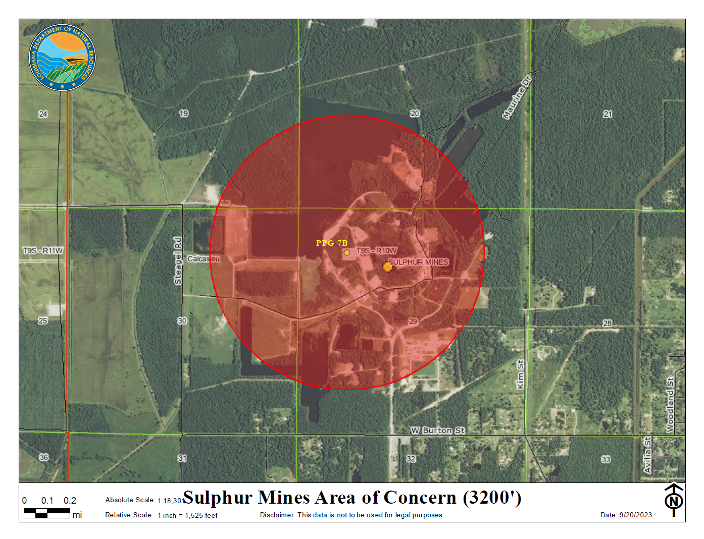
Click here for full-size version (.pdf)
Sulphur Mines Dome with Westlake property boundary:
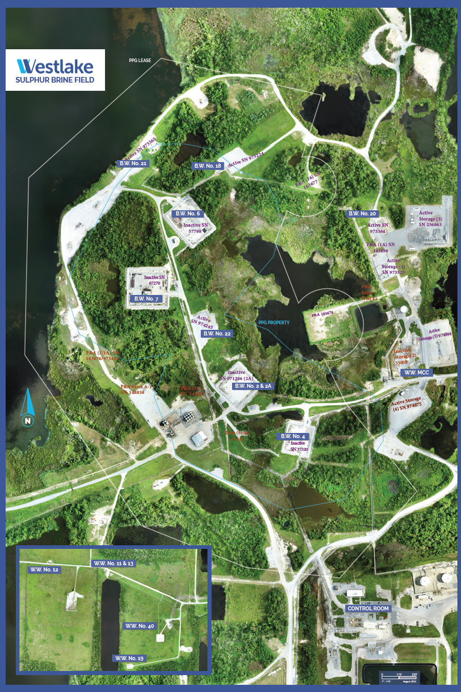
Click here for full-size version (.pdf)
Thermal Image of Sulphur Mines Dome (February 17, 2023)
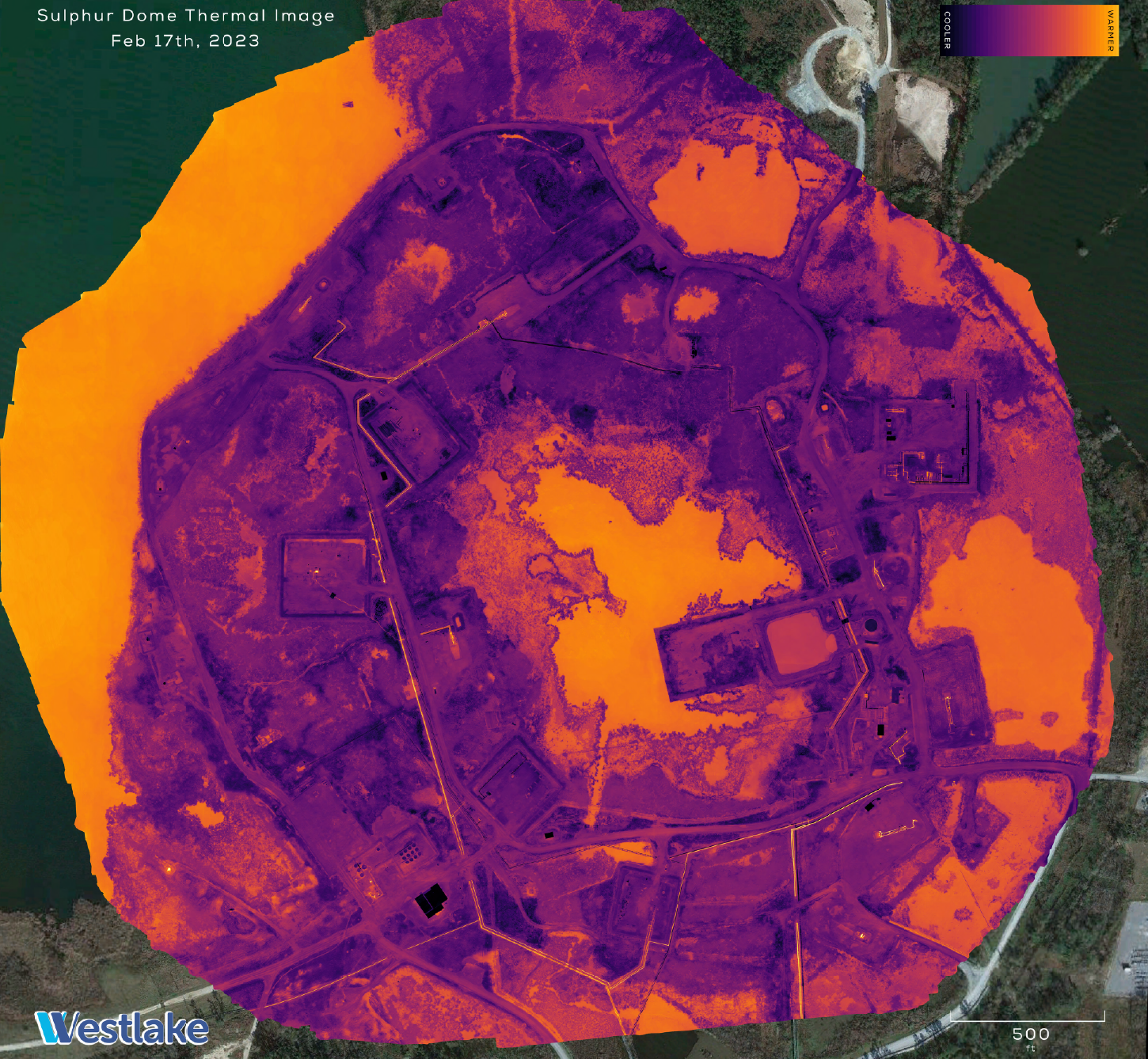
Click here for full-size version (.pdf)
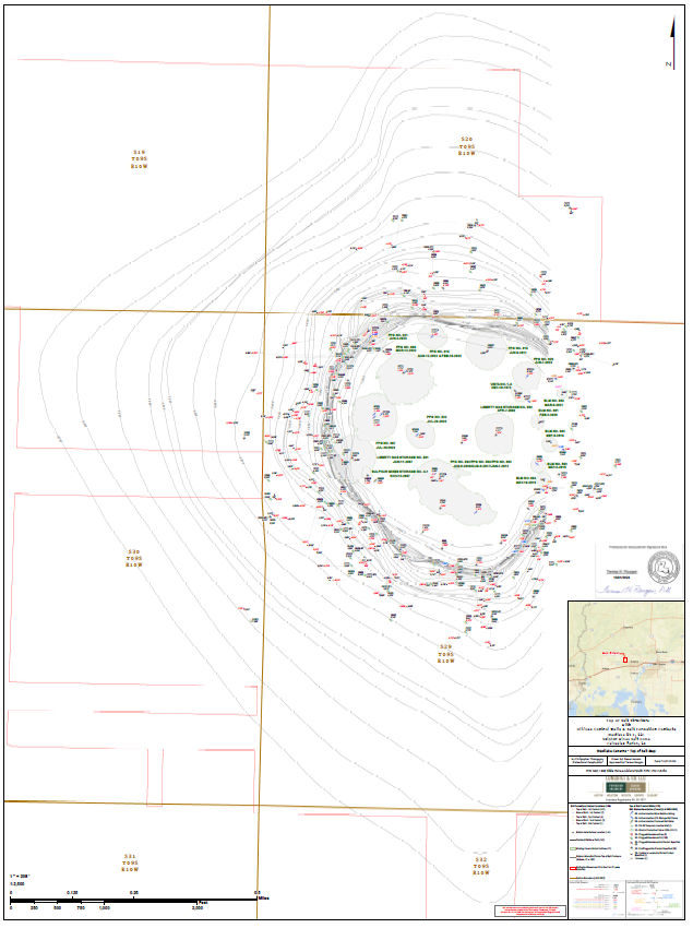
Top of Salt (TOS) Dome Contour Map for Sulphur Mines Dome (2020):
Click here for full-size version (.pdf)
Top of Salt Map - November 2023 Update
Click here for full-sized document (.pdf)
Top of Caprock Map - November 2023 Update
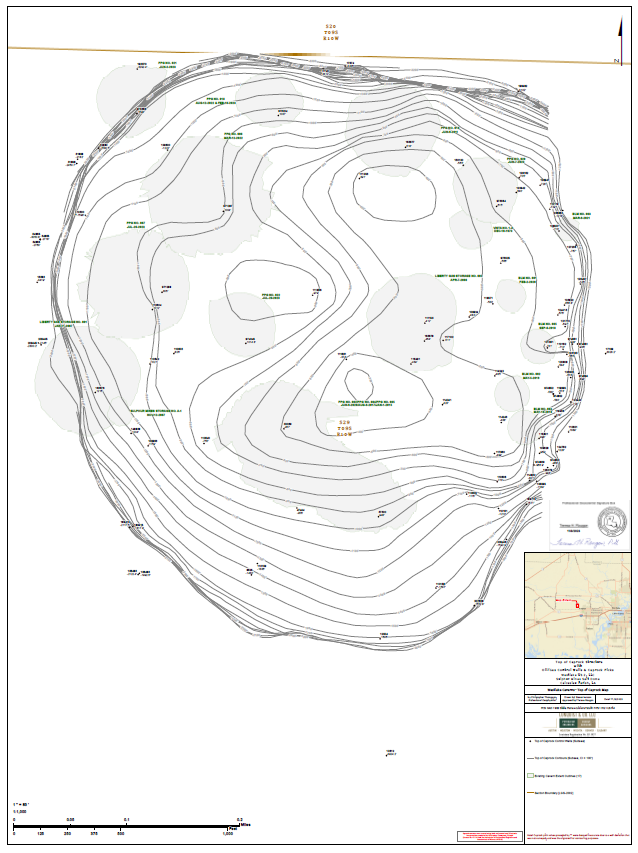
Click here for full-sized document (.pdf)
Top of Salt with Distances Map - November 2023 Update
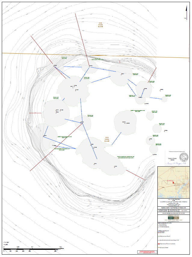
Click here for full-sized document (.pdf)
REPORT: Sulphur Mines Salt and Caprock Methodology - Received 10/27/2023
- Oil & Gas
- Energy
- Mineral Resources
- Conservation
- Coastal Management
-
Oil Spill Coordinator's Office
- Oil Spill Coordinator's Office Home
- Oil Spill Response
- Natural Resource Damage Assessment (NRDA)
- The Louisiana Regional Restoration Planning Program (RRP Program)
- Louisiana Regional Restoration Planning Program (RRP Program) Administrative Record
- Education and Outreach
- Acts, Regulations, Guidelines, & Plans
- About DENR
- Offices
- Media Center
- Contact Us
- Information Portals
- Featured Services